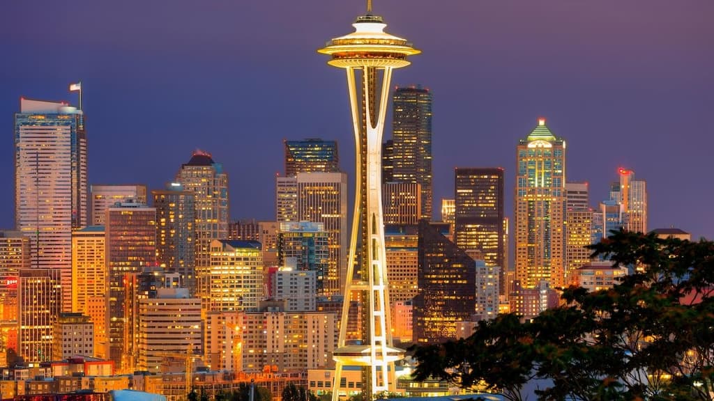
Trader consensus centers on an 80-83°F high for Seattle on August 13 due to persistent onshore flow from the Pacific marine layer moderating afternoon temperatures near the seasonal norm. National Weather Service model guidance shows stable atmospheric conditions with limited warming aloft and possible afternoon cloud cover or sea breeze effects that cap peaks, consistent with recent daily highs in the upper 70s to low 80s. Minor differences among ensemble runs hinge on exact timing of any clearing or wind shifts, creating tight spreads between the leading bins. Official observations through the evening will determine the precise maximum under standard NWS measurement protocols.
Experimental AI-generated summary referencing Polymarket data. This is not trading advice and plays no role in how this market resolves. · UpdatedHighest temperature in Seattle on August 13?
Highest temperature in Seattle on August 13?
80-81°F 42%
82-83°F 36%
78-79°F 19%
84-85°F 6%
NEW
$13,222 Vol.
NEW
$13,222 Vol.
Aug 13, 2026
73°F or below
<1%
74-75°F
<1%
76-77°F
2%
78-79°F
19%
80-81°F
42%
82-83°F
36%
84-85°F
6%
86-87°F
<1%
88-89°F
<1%
90-91°F
<1%
92°F or higher
<1%
80-81°F 42%
82-83°F 36%
78-79°F 19%
84-85°F 6%
NEW
$13,222 Vol.
NEW
$13,222 Vol.
Aug 13, 2026
73°F or below
$941 Vol.
<1%
74-75°F
$1,580 Vol.
<1%
76-77°F
$934 Vol.
2%
78-79°F
$4,190 Vol.
19%
80-81°F
$1,443 Vol.
42%
82-83°F
$985 Vol.
36%
84-85°F
$501 Vol.
6%
86-87°F
$525 Vol.
<1%
88-89°F
$1,140 Vol.
<1%
90-91°F
$563 Vol.
<1%
92°F or higher
$421 Vol.
<1%
This market will resolve based on the highest temperature recorded in the 'Daily Observations' table on Weather Underground, not the figure displayed in the 'Day High & Low' summary section; in the event of any discrepancy between the two, the Daily Observations table shall be the primary resolution source not the Day High & Low section.
This market will resolve to the temperature range that contains the highest temperature recorded at the Seattle-Tacoma International Airport Station in degrees Fahrenheit on 13 Aug '26.
The resolution source for this market will be information from Wunderground, specifically the highest temperature recorded for all times on this day for the Seattle-Tacoma International Airport Station, available here: https://www.wunderground.com/history/daily/us/wa/seatac/KSEA.
To toggle between Fahrenheit and Celsius, click the gear icon next to the search bar and switch the Temperature setting between °F and °C.
This market can not resolve until the first data point for the following date has been published on the resolution source.
The resolution source for this market measures temperatures to whole degrees Fahrenheit (eg, 21°F). Thus, this is the level of precision that will be used when resolving the market.
Revisions to temperatures recorded within this market's timeframe will be considered until the first datapoint for the following date has been published, after which any alterations will not be considered.Trader consensus centers on an 80-83°F high for Seattle on August 13 due to persistent onshore flow from the Pacific marine layer moderating afternoon temperatures near the seasonal norm. National Weather Service model guidance shows stable atmospheric conditions with limited warming aloft and possible afternoon cloud cover or sea breeze effects that cap peaks, consistent with recent daily highs in the upper 70s to low 80s. Minor differences among ensemble runs hinge on exact timing of any clearing or wind shifts, creating tight spreads between the leading bins. Official observations through the evening will determine the precise maximum under standard NWS measurement protocols.
This market will resolve based on the highest temperature recorded in the 'Daily Observations' table on Weather Underground, not the figure displayed in the 'Day High & Low' summary section; in the event of any discrepancy between the two, the Daily Observations table shall be the primary resolution source not the Day High & Low section.
This market will resolve to the temperature range that contains the highest temperature recorded at the Seattle-Tacoma International Airport Station in degrees Fahrenheit on 13 Aug '26.
The resolution source for this market will be information from Wunderground, specifically the highest temperature recorded for all times on this day for the Seattle-Tacoma International Airport Station, available here: https://www.wunderground.com/history/daily/us/wa/seatac/KSEA.
To toggle between Fahrenheit and Celsius, click the gear icon next to the search bar and switch the Temperature setting between °F and °C.
This market can not resolve until the first data point for the following date has been published on the resolution source.
The resolution source for this market measures temperatures to whole degrees Fahrenheit (eg, 21°F). Thus, this is the level of precision that will be used when resolving the market.
Revisions to temperatures recorded within this market's timeframe will be considered until the first datapoint for the following date has been published, after which any alterations will not be considered.
This market will resolve to the temperature range that contains the highest temperature recorded at the Seattle-Tacoma International Airport Station in degrees Fahrenheit on 13 Aug '26.
The resolution source for this market will be information from Wunderground, specifically the highest temperature recorded for all times on this day for the Seattle-Tacoma International Airport Station, available here: https://www.wunderground.com/history/daily/us/wa/seatac/KSEA.
To toggle between Fahrenheit and Celsius, click the gear icon next to the search bar and switch the Temperature setting between °F and °C.
This market can not resolve until the first data point for the following date has been published on the resolution source.
The resolution source for this market measures temperatures to whole degrees Fahrenheit (eg, 21°F). Thus, this is the level of precision that will be used when resolving the market.
Revisions to temperatures recorded within this market's timeframe will be considered until the first datapoint for the following date has been published, after which any alterations will not be considered.
Market Opened: Aug 11, 2026, 9:02 PM ET
Volume
$13,222End Date
Aug 13, 2026Market Opened
Aug 11, 2026, 9:02 PM ETResolution Source
https://www.wunderground.com/history/daily/us/wa/seatac/KSEAResolver
0x69c47De9D...This market will resolve based on the highest temperature recorded in the 'Daily Observations' table on Weather Underground, not the figure displayed in the 'Day High & Low' summary section; in the event of any discrepancy between the two, the Daily Observations table shall be the primary resolution source not the Day High & Low section.
This market will resolve to the temperature range that contains the highest temperature recorded at the Seattle-Tacoma International Airport Station in degrees Fahrenheit on 13 Aug '26.
The resolution source for this market will be information from Wunderground, specifically the highest temperature recorded for all times on this day for the Seattle-Tacoma International Airport Station, available here: https://www.wunderground.com/history/daily/us/wa/seatac/KSEA.
To toggle between Fahrenheit and Celsius, click the gear icon next to the search bar and switch the Temperature setting between °F and °C.
This market can not resolve until the first data point for the following date has been published on the resolution source.
The resolution source for this market measures temperatures to whole degrees Fahrenheit (eg, 21°F). Thus, this is the level of precision that will be used when resolving the market.
Revisions to temperatures recorded within this market's timeframe will be considered until the first datapoint for the following date has been published, after which any alterations will not be considered.Trader consensus centers on an 80-83°F high for Seattle on August 13 due to persistent onshore flow from the Pacific marine layer moderating afternoon temperatures near the seasonal norm. National Weather Service model guidance shows stable atmospheric conditions with limited warming aloft and possible afternoon cloud cover or sea breeze effects that cap peaks, consistent with recent daily highs in the upper 70s to low 80s. Minor differences among ensemble runs hinge on exact timing of any clearing or wind shifts, creating tight spreads between the leading bins. Official observations through the evening will determine the precise maximum under standard NWS measurement protocols.
This market will resolve based on the highest temperature recorded in the 'Daily Observations' table on Weather Underground, not the figure displayed in the 'Day High & Low' summary section; in the event of any discrepancy between the two, the Daily Observations table shall be the primary resolution source not the Day High & Low section.
This market will resolve to the temperature range that contains the highest temperature recorded at the Seattle-Tacoma International Airport Station in degrees Fahrenheit on 13 Aug '26.
The resolution source for this market will be information from Wunderground, specifically the highest temperature recorded for all times on this day for the Seattle-Tacoma International Airport Station, available here: https://www.wunderground.com/history/daily/us/wa/seatac/KSEA.
To toggle between Fahrenheit and Celsius, click the gear icon next to the search bar and switch the Temperature setting between °F and °C.
This market can not resolve until the first data point for the following date has been published on the resolution source.
The resolution source for this market measures temperatures to whole degrees Fahrenheit (eg, 21°F). Thus, this is the level of precision that will be used when resolving the market.
Revisions to temperatures recorded within this market's timeframe will be considered until the first datapoint for the following date has been published, after which any alterations will not be considered.
This market will resolve to the temperature range that contains the highest temperature recorded at the Seattle-Tacoma International Airport Station in degrees Fahrenheit on 13 Aug '26.
The resolution source for this market will be information from Wunderground, specifically the highest temperature recorded for all times on this day for the Seattle-Tacoma International Airport Station, available here: https://www.wunderground.com/history/daily/us/wa/seatac/KSEA.
To toggle between Fahrenheit and Celsius, click the gear icon next to the search bar and switch the Temperature setting between °F and °C.
This market can not resolve until the first data point for the following date has been published on the resolution source.
The resolution source for this market measures temperatures to whole degrees Fahrenheit (eg, 21°F). Thus, this is the level of precision that will be used when resolving the market.
Revisions to temperatures recorded within this market's timeframe will be considered until the first datapoint for the following date has been published, after which any alterations will not be considered.
Volume
$13,222End Date
Aug 13, 2026Market Opened
Aug 11, 2026, 9:02 PM ETResolution Source
https://www.wunderground.com/history/daily/us/wa/seatac/KSEAResolver
0x69c47De9D...Trader consensus centers on an 80-83°F high for Seattle on August 13 due to persistent onshore flow from the Pacific marine layer moderating afternoon temperatures near the seasonal norm. National Weather Service model guidance shows stable atmospheric conditions with limited warming aloft and possible afternoon cloud cover or sea breeze effects that cap peaks, consistent with recent daily highs in the upper 70s to low 80s. Minor differences among ensemble runs hinge on exact timing of any clearing or wind shifts, creating tight spreads between the leading bins. Official observations through the evening will determine the precise maximum under standard NWS measurement protocols.
Experimental AI-generated summary referencing Polymarket data. This is not trading advice and plays no role in how this market resolves. · Updated
Beware of external links.
Beware of external links.
Frequently Asked Questions